Where NEPAMesh Needs You Next
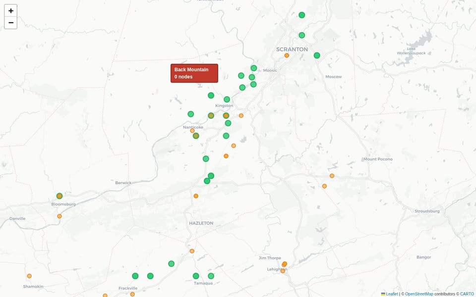
Pull up map.nepamesh.com and zoom into the Wyoming Valley. Nodes in Wilkes-Barre, Kingston, Pittston, scattered across the valley floor. The core looks healthy.
Now scroll northwest to the Back Mountain plateau. Dallas, Harvey's Lake, Lake-Lehman, Shavertown.
Nothing.
That's not a rendering glitch. Back Mountain sits roughly 400 to 500 meters above sea level, 200 to 300 meters higher than the valley floor below it. Roads, houses, and line of sight to the Wyoming Valley in every direction. Zero active NEPAMesh nodes.
Where the Network Is Strong
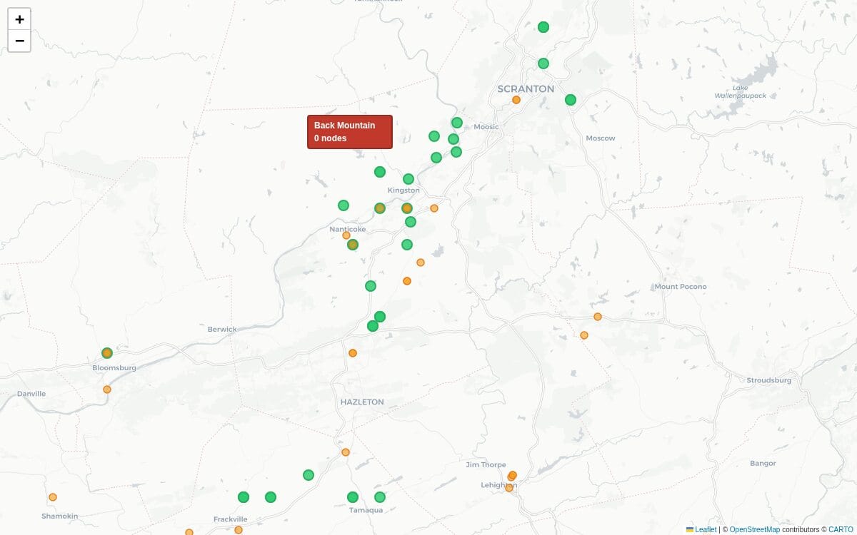
43 nodes were active on NEPAMesh in the last 24 hours. 19 of them are in the Wyoming Valley. That concentration makes sense: the valley is where most of the people are, and at valley-floor elevation those nodes cross-hear each other constantly.
Southern coalfields are stronger than they look. Fifteen active nodes, anchored by high-elevation installs that punch above their weight. Bears Head Mountain (W3TWA, 2,146 ft) is the highest active node on the network right now, running 18.4% channel utilization, one of the busiest nodes on the mesh, because altitude means it hears traffic from a long way out. Gobblers Knob has three nodes at 1,424 ft. The MIB cluster at Nescopeck Pass runs at 1,673 ft with a ROUTER and a CLIENT_BASE.
These nodes were placed deliberately, at elevation, with roles that put them to work. Plug the Bears Head coordinates into the propagation tool's placement evaluator today and it returns 0.1% marginal shadow reduction. That location is covered. There's nothing left to add because the node that's there is already doing it.
Scranton and the northern corridor have eight active nodes. Thinner, but the bones are there.
The Gap
Back Mountain ridge scores 2.0% marginal shadow reduction in the placement evaluator. Within the Wyoming Valley region, that's the highest-impact uncovered location on the network right now.
Two percent sounds small. It isn't. Bears Head and Gobblers Knob, which are carrying real traffic, come in at 0.1%. Back Mountain at 2.0% represents 20 times the uncovered terrain above Dallas as above the already-built-out southern coalfield ridgelines.
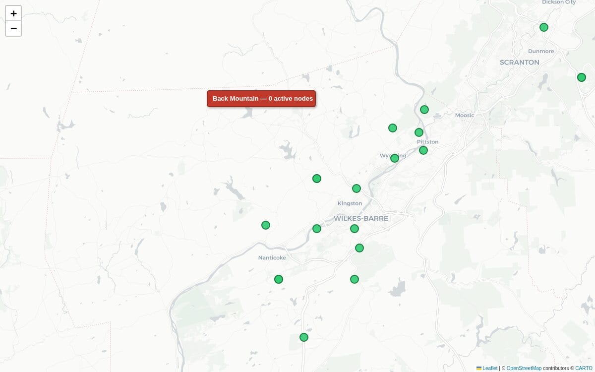
A node up there doesn't require anything special. Roofline elevation on Back Mountain is probably already 200 meters above the valley floor. No mast, no hilltop, just where the house sits. That altitude does the work.
The Nescopeck Pass Cluster
The MIB installation at Nescopeck Pass is the best example in the network of what deliberate placement looks like.
Nescopeck Pass sits on the ridge between the Wyoming Valley to the north and the Hazleton basin to the south. Without a node there, those two valleys have no RF path between them. The ridge blocks it. Put a node at 1,673 ft on that pass and packets from Hazleton-area nodes can hop north into the Wyoming Valley mesh and come back south.
What they built isn't a single radio. A ROUTER (Nescopeck Pass - nepamesh, Heltec V3) and a CLIENT_BASE (MIB Node 0, Heltec V4) run at the same location, with monitoring nodes nearby on the ridge. Two different hardware generations, both live simultaneously. CLIENT_BASE handles direct MQTT uplink. ROUTER handles RF packet forwarding. They're doing different jobs.
It started with one node. Someone put it in, it worked, and instead of walking away they added a second radio and started treating the location as infrastructure. A single node at a critical chokepoint is a single point of failure. Two nodes, different hardware, is resilient.
The shadow evaluator now returns 0.2% for those coordinates. The ridge is covered.
What One Node on Back Mountain Would Change
The 2.0% figure is a floor, not a ceiling. It's what the terrain model shows before accounting for the 19 Wyoming Valley nodes that currently have nobody on Back Mountain to relay packets to. Put a node at Dallas or Harvey's Lake and that changes immediately.
Any mobile node on Back Mountain, any handset, any portable, becomes visible to the map. Valley traffic becomes relayable onto the plateau. And with the natural elevation advantage over the valley, a Back Mountain node would hear valley nodes that lower-elevation relays miss.
A plain CLIENT with OK to MQTT on and an internet connection starts contributing immediately. CLIENT_BASE or ROUTER does more. The Nescopeck Pass cluster shows what it looks like when someone decides a location matters enough to build it out properly.
Evaluate Your Own Location
The propagation tool at propagation.nepamesh.com/suggestions has a placement evaluator at the bottom of the page. Enter any coordinates, get a shadow reduction estimate based on actual terrain data and current node positions.
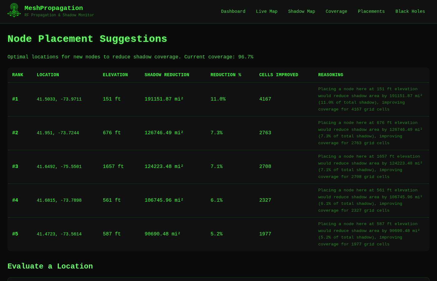
If you're on Back Mountain, run your address before buying hardware. If you're anywhere in NEPA with any elevation advantage over the nearest active nodes, run it. A 2% return for one radio is exceptional.
Getting on the Map
Full MQTT setup is at Getting Your Node on the Map. Short version: server mqtt.nepamesh.com, username meshdev, password large4cats, root topic msh/nepa, uplink on, downlink off. Nodes appear on map.nepamesh.com within minutes of MQTT being configured.
For roles: CLIENT works. CLIENT_BASE is better with a stable power and internet connection; it runs a direct MQTT uplink and relays for others. ROUTER is for elevated nodes that want to prioritize RF forwarding. Nescopeck Pass runs both a ROUTER and a CLIENT_BASE at the same location because the two roles do different things.
Questions about placement, role config, or coordinating with nearby nodes go in the NEPAMesh Discord. The people who built the Nescopeck Pass cluster are there.
The map fills in one node at a time. Back Mountain is next.
NEPAMesh is a community Meshtastic network covering Northeastern Pennsylvania's Wyoming Valley. Live map at map.nepamesh.com. Questions in the Discord.
Meshtastic is a registered trademark of Meshtastic LLC. No warranty is provided. Use at your own risk. This post is not endorsed by or affiliated with Meshtastic LLC.